Latitude: 33.830, Longitude: -84.400
Receiver: unknown
Marist School and Atlanta Area Weather Forecast
Click on any satellite image below for a full sized image. Times are shown in Eastern Standard Time.
Current Conditions at the Marist Weather Station.
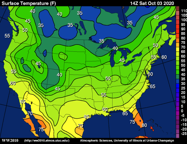
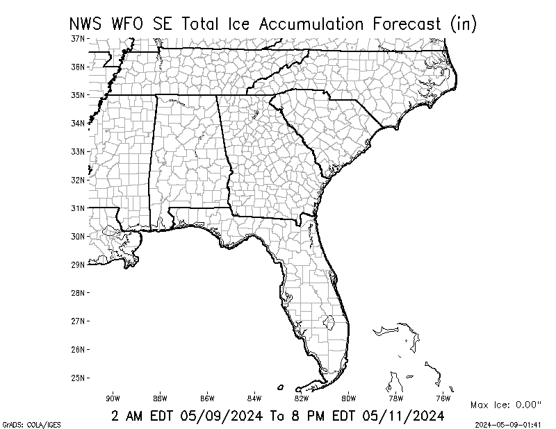
Current Weather Maps and Radar.
Satellite Images From Around The World.


Your browser does not support iframes.
-->Weather Maps and Radar Images


Nancy Creek Stream Levels

Weather Related Links
- Marist School Current Weather
- Marist School Weather Forecast and Weather Data Archive
- Marietta Georgia Weather Forecast and Weather Data Archive
- Atlanta NOAA Current Radar
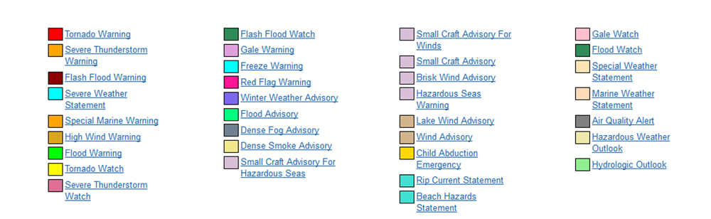
- Watch, Warning, Advisory Display Map
- National Hurricane Center
- Georgia Emergency Management Agency (GEMA)
- Additional Worldwide Weather Satellite Images
- Weather Conditions at CWOP Station DW1905 Marist School
- Weather Conditions at CWOP Station EW9439 Marietta GA
- Atlanta Allergy and Asthma Clinic Pollen Count
- Space Weather
- USGS Real Time Streamflow Data for Georgia
- Skywarn
Marist School NOAA Weather Satellite Images


 Top
Top
About the EnhancementsThis page shows just some of the 35 enhancements WXtoImg provides: |
|
MSA |
Multi-Spectral Analysis: combines a sensor 1 or 2 (visible/near infrared) image with a sensor 4 (thermal infrared) image to create a near true colour, near visible image of the earth. |
MCIR-precip |
Map Coloured IR with Precip: uses sensor 4 (thermal infrared) to create a false coloured image showing areas of likely precipitation. The likelihood and intensity of precipitation increases as the colour goes from green to yellow to orange to red to black to white. |
HVCT |
HVCT false colour: creates a false coloured image by combining a sensor 1 or 2 (visible/near infrared) image with a sensor 4 image (thermal infrared) to create an image in which clouds are tinted by their temperature. |
Pristine |
These are images as they come from the satellite without alteration. The earth appears "upside down" on Northbound passes. The two images are the two channels sent by the satellite with channel A (left) switching between sensor 1 (visible) or 2 (near-IR) during the day and sensor 3 (mid-IR) at night and channel B (right) showing sensor 4 (thermal-IR) at all times during normal operation. |
| Thermal | Thermal: Creates false color images using the temperatures from (sensor 4) Thermai Infrared image. This sensor covers the full range temperatures from very cold cloud tops to very hot deserts. |
SST |
Sea Surface Temperature: creates a false colour image by combining sensors 3 and 4 (Infrared) and using a pre-defined palette colour the image. |
Next Scheduled Satellite Passes over Atlanta, United States
* local time is Eastern Standard Time. |
||||||||||||||||||||||||||||||||||||||||||||||||||||||||||||||||||||||||||||
Worldwide Satellite Image Links
| North America | South America | Europe | Asia | Africa | Australia-New Zealand |
|---|---|---|---|---|---|
|
Enregistrées à St Pierre (Terre Sainte), La Réunion, Indian Ocean east of Madagasgar. |
|
|||
| San Francisco CA, USA | Fevik, Norway. |
|
|
||
| Plymouth, MA., USA. | |||||
| The Awty International School, Houston TX, US |
|
||||
| Port Alberni, BC, Canada | |||||
| Grootegast, Netherland | |||||
|
|||||
|
|||||
|
|||||
|
|
||||
|
|||||
|